Signing off at the end of a long day

The Great Ocean Rode is another great road journey and on a fine morning offers the beauty of limestone stacks, jewelled ocean and foaming waves.


London Bridge (above) may no longer be connected to the mainland but is a handsome view.

Further along, Melba Gully is a shady rainforest of towering beeches where tree ferns flaunt their feathery skirts and brilliant orange bracket fungus winks from below tree trunks. Such contrast of light and dark is fiendishly difficult to capture on camera.


As we leave Queenscliff, we bid adieu to the boats in the marina and sail into the sunset until the next trip.


Homeward bound

  
Last February while in Mount Gambier we enjoyed coffee and delicious cakes at Cafe Metro. We also stocked up on comfortable clothes at reasonable price at the Rivers outlet.

So we left Robe this morning and decided to revisit Mount Gambier and both these businesses. We weren’t disappointed. After coffee and yummy Sicilian cartocci (cannoli filled with orange flavoured custard) at Metro, we did a lightning shop at Rivers and are fitted out for the end of winter.

By lunchtime we crossed the state border and stopped at Bird Bath roadside rest area, Dartmoor, which has a natural spring. It was a long-settled area with streets lined with wild daffodils and an old rail line.

  
We are overnighting at the coastal town of Warrnambool, where we have enjoyed a delicious dinner at Old Clovelly restaurant and a sound and light reenactment of the shipwreck of the sailing ship Loch Ard. Cameras were banned from the Shipwreck show, but here’s the fish with risotto and rocket salad. David had chicken with rice cauliflower and bok choy.


Winter beach combing near Robe

  
South of Robe is an ocean beach with wild waves.


 As the waves crash and spray on the rocky outcrops, the receding tide throws up treasures from the ocean: kelp, plastic trash broken and distorted, bottles encrusted with cockles, feathers, driftwood.


As we basked in the noontime glare, we noticed some translucent opaline shapes that may be shark eggs?

  
Behind the dunes is a freshwater lake where hoary-headed grebes, black swans and musk ducks feast on the underwater grasses.


It’s a soothing contrast to the charged energy of the ocean waves.

Coorong walk after rain

  
The Coorong is a system of lakes behind the dunes in the southeast of South Australia. It includes samphire swampland and melaleuca. This morning, we pulled into the Coorong National Park at Chinamen’s Well, which we had visited six weeks ago coming over from Victoria. Suddenly the rain stopped and we leapt outside to tackle a nearby walk: the Nakun Kangun, which runs for 27km along the Coorong.

  
Some of the walk was through melaleuca forest (see above), past samphire lakes.

  
There were delicate orchids if you looked carefully.

  
Correa:


We continued to Kingston SE, which has a cool historic lighthouse.

  
Finally, we are in Robe, where we have caught up with family in the first house we have been in for nearly seven weeks.

Windswept Wikicamp inspiration 

  
After a cheery roadside coffee break opposite a fertile field of some vegetable north of Adelaide, we took turns driving with me steering the ‘rig’ south to just outside Adelaide and David taking over for the tricky urban section through the suburbs of a capital city.

  
This meant a late lunch of packet soup and cheese toastie on a side road, near Murray Bridge. The sky looked ominous (see above) and we thought we’d better settle into a sheltered campsite soon.

Using the useful app Wikicamps, we located an old alignment and driving through high winds and rain, finally nestled in behind a large sand dune. It provides shelter from the traffic noise but the dune is in the leeward side, so we still are buffeted by wind. 

  
Our gas fridge wouldn’t stay alight, so Dave has rigged up a fix using a canvas cover he purchased to keep heat (!) off the back of the fridge.

  
Putting on my raincoat, I couldn’t resist playing with the creative function on my compact camera to get some interesting effects: windswept tree, our lonely campsite, a child’s abandoned Croc.


The rain has now abated and a herd of cows is staring dumbfounded at us. So it’s not as lonely after all. A camper’s life is full of surprises.

Remarkable walks

  
Mt Remarkable National Park, just south of Port Augusta in South Australia, is well named. Although it is on the Goyder line and turned out to be unproductive for grazing, it supports huge river red gums. Apparently, the secret is Mambray Creek, which only flows in wetter periods, has underground counterparts which the deep-rooted gums are able to access and siphon upwards.

We did three walks and the first was among the gums, which continue to thrive even after they are hollowed out by fire and termites. Can you see David, cleverly concealed inside this one?

  
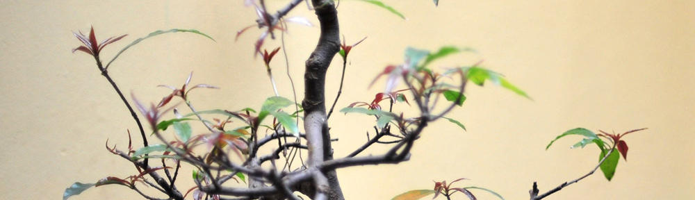
Along the river were native pines as well as gums, affording a pleasant shade.

  
After a caffeine fix, with sandwiches in our backpacks and we headed off on a second walk, this time to Sugargum Lookout.Ironically, the view from the lookout was almost obliterated by sugar gums!

However, a historic shepherd’s hut proved a pleasant lunch stop.

  
The spring wildflowers were beginning, including this native hibiscus:

Bulbine lily:

  
In the late afternoon we tackled a short walk to the ruins of the original homestead, where generations of lessees had struggled to make a living grazing sheep. The cemetery provided a moving reminder of how harsh life was for families, with several graves of children.

  
Threatening clouds and the lure of King Island Blue Ash cheese with a pre-dinner drink called a halt to play and we returned to the caravan, but not before I had uploaded yesterday’s blog near the park entrance, which had 3G connection.

Driving along Mr Goyder’s line

  
Leaving our caravan park in the grounds of the Poochera pub, north of the Eyre Peninsula, South Australia, we stopped for home- brewed espresso at a stop with a historic marker. It commemorates Goyder’s line, delineating the limit for agriculture. Remembering my Geography teaching, I seem to recall that the line roughly follows the 10″ isohyet. 

However across the other side of the rock marking the Line was a crop of wheat, so it seems that one farmer is challenging Goyder’s theory. The bushland where the rest area was located was mallee eucalyptus with a sandy base and samphire under-storey. It looked fairly arid.

  
David is doing his bit to keep wayside rest areas beautiful by picking up litter while I brew coffee in the van.

  
As we drove east past Iron Knob to Port Augusta, wheat gave way to sheep grazing on saltbush. And mining. I photographed the Knob of Iron Knob, which over the years has been reduced in the mining of iron ore.

  
After refuelling and restocking with fruit cake at Port Augusta, we dipped back below Goyder’s Line to camp at Mt Remarkable National Park. The river red gums indicate that this is indeed an area of higher rainfall, reminding us that moister areas have their own beauty.


It’s been a hard day’s drive

  
to paraphrase a Beatles song. We drove from 10:00am to 5:00pm with breaks. Dave did 90% of the driving and I had a half hour’s van towing lesson, but I think Dave finds it as tiring being a passenger as driving because he is instructing me. Hopefully I will gradually be more help, but navigating using Hema maps on the iPad and Wikicamps is more to my liking.

I did take some photos as we edged steadily east across the South Australian section of the Nullarbor. We shared the highway with road trains. The sign on the back of this one says that it’s 37 metres long.

 Then a police car came towards us on the wrong side of the road, lights flashing. This was to warn us of an extra wide load carried by an approaching vehicle. It turned out to be two trucks each with a mining bucket that took up both lanes of the Eyre Highway.

  
Gradually civilisation encroaches, reminding us that our holiday is finishing soon. Our lunchstop the rest area was bounded by a fence with wheat planted the other side, plus powerlines and underground cable. A far cry from the unfenced wilderness plain that we had spent the last four days traversing.Edit

  
At Esperance we submitted our Nullarbor Links scorecard to the Information Centre and David proudly took possession of a Certificate of Completion, including his score – 146! The attendant said that the highest score she had processed was over 400! What with crows stealing balls, saltbush concealing them and trees concealing the greens, it’s a miracle that he finished at all.

We are now at a cosy caravan park and pub at Poochera, in South Australia’s wheat belt. Major Mitchell cockatoos, with their pink plumes, flutter and squawk around the gleaming silos. After four nights in the bush, it is a luxury to wash hair and clothes and enjoy pub-cooked fresh whiting from nearby Streaky Bay. But we will always cherish our memories of the vast Nullarbor plain and its beautiful southern seascapes.


Nullarbor musings with bikers

  
Departing late from our bush camp, (due to the time change), we returned to Border Village to fill a gas cylinder. While there we met a couple who had ridden a motorbike with trailer from Devonport in Tasmania. 

Further down the Eyre Highway, while pulling into a lookout to check out the Merdayerrah Sandpatch at the start of the Bunda Cliffs, we met them again. The trailer opens out to a double bed. They carry a small icebox for perishable food and  the bike is equipped with a GPS. When they got wet, they checked into a cabin for the night to dry off. They weren’t enjoying the windy morning, but overall were having a great trip.

The next lookout was over the Bunda Cliffs, which come abruptly out of the sea and stretch as far as the eye could see.

  
The word Nullarbor is Latin for ‘no trees’, but the Nullarbor Plain only lives up to its name on the Eyre Highway for a few, monotonous kilometres. The rest is scrubland and mallee (multiple trunked eucalyptus).

  
Once again, we visited Head of Bight, where hundreds of Southern Right Whales come annually to give birth and nurse their calves. I took some more photos, but it’s hard to zoom in and snap them at the moment they do something interesting. Most of the time they just lie flat in the sea, but occasionally they blow water or stretch a fin.

  
This evening we have found a lovely camp in Mallee bushland. The coastal dunes are visible on the horizon, but here it is sheltered with blue bush and little flowers. Once again we had a beautiful sunset.


Caiguna golf finale and Variety meeting

  
We awoke to a brilliant sunrise with the moon setting over the mallee scrub.

First challenge of the day was the Nullarbor Links hole at Caiguna. Called ’90 Mile Straight’, it is a par 4 course traversing saltbush, with trees in the fairway and the green out of sight around a bend. Usually, we are the only players, but this time another couple were ahead of us and they’d already played two holes at other roadhouses.

  
We have now completed the ‘World’s Longest Golf Course’ and have only to pick up our certificate once we get to Ceduna.

We then had to turn our clocks forward three-quarters of an hour to a special Nullarbor time zone that only applies to a few roadhouses in the east of Western Australia. 

The caravan park at Eucla was booked out by 120 vehicles of the Variety Club, who were doing their annual ‘Bash’ from Sydney to Bundaberg using creatively decorated vehicles. One was a refurbished hearse. There was also a large support vehicle with group equipment and supplies.

  
We crossed the border into South Australia where more decorated Variety Club vehicles were queuing for the quarantine check.

  
Nine kilometres further, we found a bush camp that was listed in Wikicamps. It isn’t far from the coast. We are loving our third night camping out in this beautiful wilderness.