Natural gardens in the rain and Hippo Rock

Today it has rained seriously from morn till night. Despite this, we walked to Hippo rock, a short distance from the camping ground at Wave Rock. The track was wet.

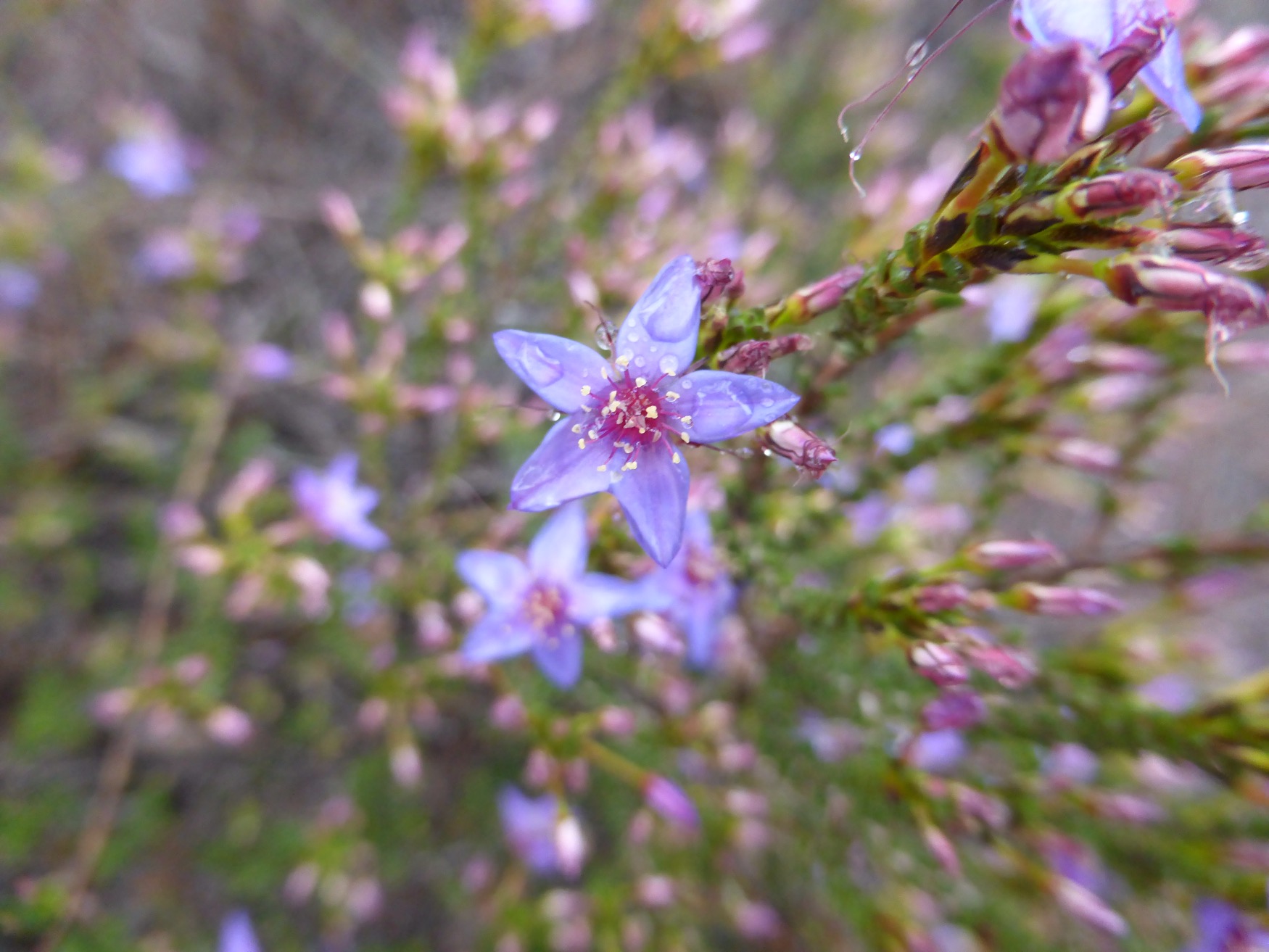
We drove past soggy emerald green wheat fields and stopped for lunch at Pallarup Nature Reserve. After beef and noodle soup with cheese toastie, the rain abated briefly leaving great conditions for a photo shoot, with raindrops dripping from wildflowers and creeklets flowing over the granite rocks. We saw our first orchid – sorry the photo is on an unconventional angle – as it was I had to lean over double to avoid damaging it or its neighbours.


The picture below is Hippo Rock, Hyden, this morning.  

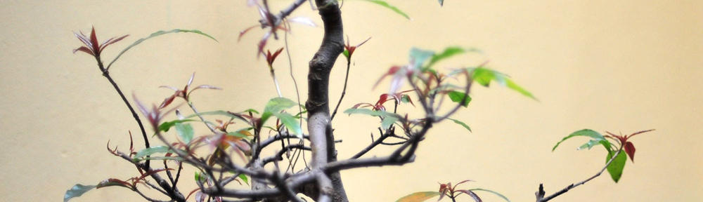
Here are two random photos of mallee plants in the rain.


We are now at the southern port of Hopetoun. To reward ourselves for spending a day in the rain, we decided to have dinner at the pub. The meal was fantastic, but it took us 20 minutes to find our way out of the caravan park, which is an absolute maze!

Bunny fencing and Rock waving near Hyden

  
Few caravan parks over here offer wifi so when we learnt from a fellow camper Northam has free wifi at Macdonalds, we hightailed it into town for me to upload the blog photos over coffee. 

I returned to the car to see David striding happily down the street with a supermarket bag. He’d found a Woollies and had stocked up with his favourites – Chocolatte, Bengal Spice, ricotta and fresh rolls, plus his favourite caravan magazine. So for lunch we feasted on rolls with prosciutto, cheese and salad with mango chutney. Yum.


We had been driving through West Australia’s wheat heartland and lunched at a roadside reserve that showed what the indigenous vegetation was like before clearing: jam casuarina and eucalyptus woodland.

Our road followed the rabbit proof fence. This ambitious project was to build hundreds of kilometres of wire fencing with the aim of preventing the relentless march of rabbits from the eastern states to the wheatbelt. Rabbit traps were set up beside the fence. 

  
The rabbits go into a cage and the locals took them out to eat. But as a project, the rabbit proof fence failed – floods, fires, fallen trees and people leaving gates open meant the rabbits soon were just as numerous either side.

We are now at Wave Rock, (see top picture) a natural granite feature where wind and rainwater erosion has eroded the rock into an unusual shape. The rock is used to collect water for the settlement of Hyden.

  
 The caravan park is spacious and we had barbecued steak for dinner under the annex.

Cutting the corner via Yanchep

As we had toured the southwest corner and Perth a few years ago, we decided to just go down the Indian Ocean Drive, head inland to Yanchep National Park, take the Perth freeway and turn east to the town of Northam.

The morning was clear and we awoke to the best view in Guilderton, right on the estuary of the Moore River. Pelicans were fishing from the sandbar and the sun reflected off the limestone cliffs.

  
We headed along the scenic coastal route to the village of Two Rocks, past a lot of new development at Yanchep, which is obviously a sea change destination. 

Yanchep National Park, an intriguing walk down memory lane. The 1930s buildings reminded me of Wattle Park Chalet, near our former home in the Melbourne suburb of Burwood. There was even an old tramcar, like our children used to play on at Wattle Park. 

  
We had coffee at the tea rooms, so our macho off-road hero (David) was forced to endure pink table cloths and plastic pink roses. The chocolate rum and raisin was a rich treat.

  
We took a walk around the shortest of several trails. It took us through karst bushland with collapsed limestone caves and tuart eucalypts with Carnarby’s cockatoos and kangaroos. 

  
We had a healthy prosciutto and salad sandwich in the van before trundling down the Reid Highway around the edge of Perth and 100km east to Northam. We are back near the historic pipeline that brings water from a dam at Mundaring to the gold town of Kalgoorlie.

The pinnacle of a rainy day

We had a cosy night camped beside a paddock of fussing sheep and lambs, where the huge ring around the half moon presaged that rain was to come. 

We drove to The Pinnacles in Nambung National Park. This is a weird sandy desert environment filled with limestone pillars.

  
We had lunch in the van at Nilgen Nature Reserve and walked around an incredible density of blooming wildflowers. Western Australia has an amazing diversity of wildflowers.

  
We are now one of several vans in an almost empty caravan park at the coastal village of Guilderton at the estuary of the Moore River, just an hour north of Perth. At last the rain has cleared; we put on a load of washing and drying and went for a walk to a lookout over the river with its sandbar, the beach and the dunes as the sun set.


Wildflower madness today in southwest of WA

We’re following the Indian Ocean Drive from just south of Port Dennison (after I uploaded yesterday’s blog via the free wifi on the foreshore). Coffee stop was at Cliff Head, where I photographed a clematis flower while David chatted with campers.

  
The coastal drive is really interesting and apparently only recently sealed, so we had to stop briefly at Leeman, or Snag Island as it was called until 1972. It’s a quiet little seaside town with a cormorant-covered island just off the end of the jetty.

Then to Point Louise just north of Green Head for lunch and a rock clamber in the sunshine, gazing across to the next little holiday settlement.

I had read about the Lesueur National Park and was keen to visit it, which we did. It was a wonderland of wildflowers, with over 900 species. I found and photographed about forty in bloom today.

My favourite was the Djanda, which has lovely pinky flowers and the sun behind the leaves shows the grains.

  
This is a zamia, an ancient form of plant called a cycad.

  
I loved the banksia that looked like an acorn.

  
There was a healthy early nancy, showing that spring isn’t far away. It is often called the ‘harbinger of spring’.

  
The kingia is an interesting tree-like grass.

  
I’ll finish with this feathery flower.


We couldn’t get enough of Greenough 

The word ‘enough’ gives a reminder of how to pronounce Greenough (‘Grenuf’). But let’s start at yesterday’s first stop; leaving Eurardy we drove to a well-known free camp beside a bridge on the Murchison River. As Wikicamps users had reported, it was very popular although some of the ground was damp.

  
Leaving the Great North West Highway, we took a scenic route to Geraldton and then down the coast to the historic settlement of Central Greenough, a National Trust set of properties.

They had been carefully restored in the 1970s and we spent an hour going between school, churches, gaol and convent between the llamas, who kept the grass down.

   
 This gave time for the group of bikers to be served their lunch, although they had used up the supplies of cottage pie, so we were left with lasagne, dearer but delicious.

We watched surfers tackling the surf at Flat Rock, and I am filled with admiration for photographers who cover surfing events – apologies for the poor focus – the camera couldn’t adjust fast enough!

  
Last night’s sunset view shows the pretty reflections at Port Denison marina. We have spent the night at a caravan park and are now using the free wifi on the foreshore before we head further down the West Australian coast.


Cockles on beaches and cockies with wildflowers

Reluctantly we have begun our return trip, heading out of the town of Denham and the Shark Bay area, stopping briefly to admire Shell Beach, which is made entirely of minute cockle shells.

  
Our lunch stop was on the red earth by the roadside.

  
We decided to stop just outside the Eurardy Station, a property of 38,000 hectares that was purchased by conservation organisation Bush Heritage Australia in 2005. It is in the heart of wildflower country and has an interesting roadside mailbox.

  
I photographed some delicate wildflowers while a flock of red-tailed black cockatoos socialised overhead.

  
We were rewarded with a spectacular sunset and a brilliant display of stars, moon and planets. It is worth bush camping to see far horizons and outback skies.


Red earth, pastel sea, sky and beach – with wildflowers in stunning colours

Francois Peron National Park is in the Shark Bay World Heritage area. Access is by 4WD only and you need to deflate tyres to 20psi. A compressor is provided for drivers to re-inflate tyres prior to returning to the bitumen.

Visually, the scenery is stunning – the dunes are a deep red, while the sand on beaches is creamy with shell-encrusted limestone. The beach has streaks of mauve stains from the offshore sea grass meadows that dugongs graze on.

  
The Tamala rose is one of the more colourful wildflowers in the heathland.

  
There is also the Shark Bay daisy.

  
White pig face:

  
Coastal thryptmene is common on the coastal cliffs and dunes on the Peron peninsula..

  
When we returned to the Peron homestead, we took a dip in the natural hot tub as the light faded.


Dolphins and goanna magic at Monkey Mia

We had to leave our caravan park at 7:00am to get to Monkey Mia for the 7:45am feeding. Only a few dolphins are hand fed and they are only given three fish each, so they maintain their hunting skills and continue to feed their young. Two to four volunteer workers select three privileged people amongst the two hundred onlookers and they get to give the Dolphins a fish. Dolphins can be distinguished by their dorsal fins and today Puck and Surprise graced us with their presence.

  
Puck is eying off the bucket knowing that she will soon be offered a fish.

  
Volunteer worker selects a child to give puck her fish. They are allowed to choose a sibling or friend to accompany them in the task.

  
Visitors await the dolphin feeding as a marine biologist in the foreground gives a commentary.

We returned via the Red Bluff I’m Francois Peron National Park, where a goanna was sitting on the beach almost between David’s legs – to the delight of us and some French visitors.


Kalbarri to Shark Bay – pelicans and stromatolites

We left Kalbarri just as the daily 7.45 pelican feeding was finishing. I photographed it from across the road as I was walking to the supermarket for soda and lime.

imageimage

We progressed back to the Great Northern Highway through the wildflower heathland of yesterday’s national park, coming eventually to Overland Roadhouse, where we stopped for fuel and I snapped the surface water – clearly it had been raining here recently.

We started into the Shark Bay World Heritage Area. Lunch stop was at Hamlin Pool, an seaside inlet with an unusually high salinity level. The result is that an ancient life form called stromatolites have formed and are continuing to flourish.

Nearby is a nineteenth century telegraph station that played a small role in the Gemini space program in 1964 when lightning struck the relaying system, necessitating a return to morse code communications for several hours.